
Semeru topographic map
Interactive map
Click on the map to display elevation.
About this map
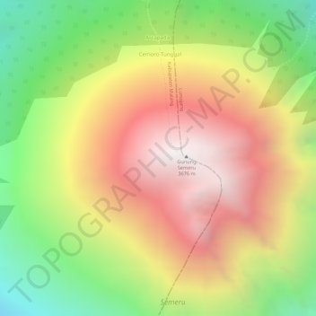
Name: Semeru topographic map, elevation, terrain.
Location: Semeru, Malang, East Java, Indonesia (-8.10805 112.91995 -8.10795 112.92005)
Average elevation: 3,097 m
Minimum elevation: 2,440 m
Maximum elevation: 3,660 m