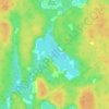
Click on the map to display elevation.
Name: Lansdowne topographic map, elevation, terrain.
Location: Lansdowne, Digby Municipal District, Digby County, Nova Scotia, B0V 1A0, Canada (44.55707 -65.75283 44.61206 -65.68874)
Average elevation: 108 m
Minimum elevation: -4 m
Maximum elevation: 167 m
Click on a map to view its topography, its elevation and its terrain.
Canada > Nova Scotia > Digby County > Bay View
Average elevation: 44 m
Canada > Nova Scotia > Digby County > Hectanooga
Average elevation: 65 m
Canada > Nova Scotia > Digby County > Lake Midway
Average elevation: 58 m
Canada > Nova Scotia > Digby County > Morganville
Average elevation: 143 m
Canada > Nova Scotia > Digby County > Mount Pleasant
Average elevation: 115 m