
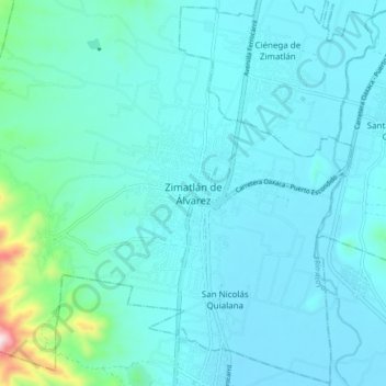
Zimatlán de Álvarez topographic map
Interactive map
Click on the map to display elevation.
About this map
Name: Zimatlán de Álvarez topographic map, elevation, terrain.
Location: Zimatlán de Álvarez, Oaxaca, 71200, México (16.82728 -96.82494 16.90728 -96.74494)
Average elevation: 1,538 m
Minimum elevation: 1,471 m
Maximum elevation: 2,079 m