
Corcelles-Cormondrèche topographic map
Interactive map
Click on the map to display elevation.
About this map
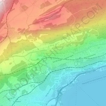
Name: Corcelles-Cormondrèche topographic map, elevation, terrain.
Location: Corcelles-Cormondrèche, Neuchâtel, 2035, Suisse (46.96522 6.84886 47.00522 6.88886)
Average elevation: 617 m
Minimum elevation: 422 m
Maximum elevation: 920 m
Other topographic maps
Click on a map to view its topography, its elevation and its terrain.