
Thank you for supporting this site ❤️
Make a donation
Make a donation
El Cortijo Grande topographic map
Click on the map to display elevation.
Thank you for supporting this site ❤️
Make a donation
Make a donation
About this map
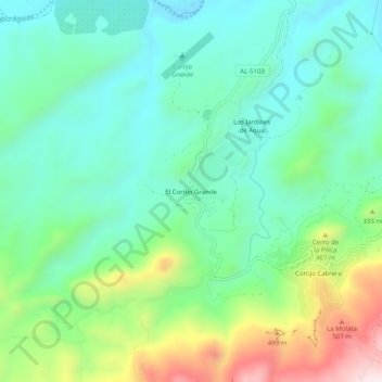
Name: El Cortijo Grande topographic map, elevation, terrain.
Location: El Cortijo Grande, Turre, Almería, Andalucía, España (37.10142 -1.95485 37.14142 -1.91485)
Average elevation: 230 m
Minimum elevation: 63 m
Maximum elevation: 646 m
Thank you for supporting this site ❤️
Make a donation
Make a donation
Other topographic maps
Click on a map to view its topography, its elevation and its terrain.