
Punta Hermosa topographic map
Click on the map to display elevation.
About this map
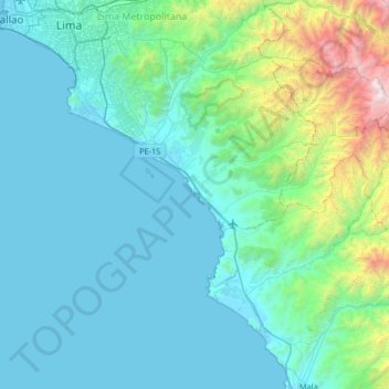
Name: Punta Hermosa topographic map, elevation, terrain.
Location: Punta Hermosa, Lima, Lima Metropolitana, Lima, 15851, Perú (-12.66167 -77.14528 -12.02167 -76.50528)
Average elevation: 471 m
Minimum elevation: -1 m
Maximum elevation: 3,750 m