
Thank you for supporting this site ❤️
Make a donation
Make a donation
Hameldon Hill topographic map
Click on the map to display elevation.
Thank you for supporting this site ❤️
Make a donation
Make a donation
About this map
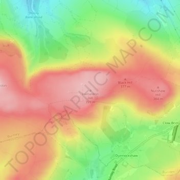
Name: Hameldon Hill topographic map, elevation, terrain.
Average elevation: 309 m
Minimum elevation: 193 m
Maximum elevation: 405 m
Thank you for supporting this site ❤️
Make a donation
Make a donation
Other topographic maps
Click on a map to view its topography, its elevation and its terrain.
Houghton Hagg Wood
United Kingdom > England > Lancashire > Burnley > Worsthorne
Average elevation: 192 m