
Thank you for supporting this site ❤️
Make a donation
Make a donation
Mendenhall Lake topographic map
Click on the map to display elevation.
Thank you for supporting this site ❤️
Make a donation
Make a donation
About this map
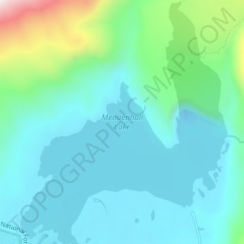
Name: Mendenhall Lake topographic map, elevation, terrain.
Location: Mendenhall Lake, Juneau, Alaska, United States (58.41228 -134.59182 58.44553 -134.53774)
Average elevation: 152 m
Minimum elevation: -10 m
Maximum elevation: 877 m
Thank you for supporting this site ❤️
Make a donation
Make a donation
Other topographic maps
Click on a map to view its topography, its elevation and its terrain.
Thank you for supporting this site ❤️
Make a donation
Make a donation
Thank you for supporting this site ❤️
Make a donation
Make a donation