
Thank you for supporting this site ❤️
Make a donation
Make a donation
Dhunibesi topographic map
Click on the map to display elevation.
Thank you for supporting this site ❤️
Make a donation
Make a donation
About this map
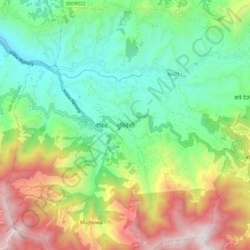
Name: Dhunibesi topographic map, elevation, terrain.
Location: Dhunibesi, Dhading, Bagamati Province, Nepal (27.67713 85.12051 27.75713 85.20051)
Average elevation: 1,318 m
Minimum elevation: 723 m
Maximum elevation: 2,386 m
Thank you for supporting this site ❤️
Make a donation
Make a donation
Other topographic maps
Click on a map to view its topography, its elevation and its terrain.