
Spire topographic map
Interactive map
Click on the map to display elevation.
About this map
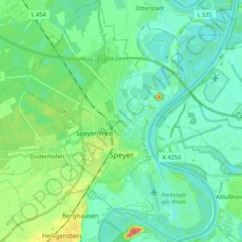
Name: Spire topographic map, elevation, terrain.
Location: Spire, Rhénanie-Palatinat, Allemagne (49.28306 8.37685 49.37601 8.49183)
Average elevation: 100 m
Minimum elevation: 89 m
Maximum elevation: 134 m
Other topographic maps
Click on a map to view its topography, its elevation and its terrain.
Spire
Allemagne > Rhénanie-Palatinat > Spire
Spire, Speyer, Rhénanie-Palatinat, 67346, Allemagne
Average elevation: 101 m