
Belmont-Broye topographic map
Interactive map
Click on the map to display elevation.
About this map
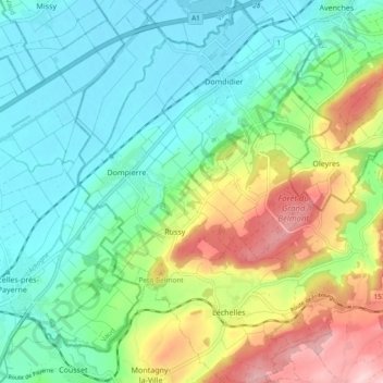
Name: Belmont-Broye topographic map, elevation, terrain.
Location: Belmont-Broye, District de la Broye, Fribourg, Suisse (46.81657 6.97695 46.88078 7.05554)
Average elevation: 512 m
Minimum elevation: 434 m
Maximum elevation: 684 m
Other topographic maps
Click on a map to view its topography, its elevation and its terrain.
Léchelles
Suisse > Fribourg > Belmont-Broye > Vigny
Léchelles, Route de Payerne, Vigny, Belmont-Broye, District de la Broye, Fribourg, 1773, Suisse
Average elevation: 593 m