
Make a donation
Quissongo topographic map
Click on the map to display elevation.
Make a donation
About this map
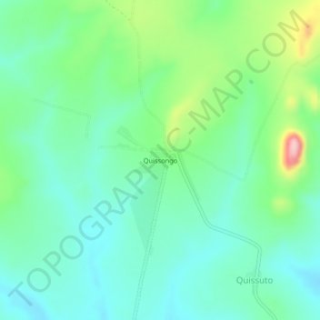
Name: Quissongo topographic map, elevation, terrain.
Location: Quissongo, Cuanza Sul Province, Angola (-10.05639 15.06118 -10.01639 15.10118)
Average elevation: 1,217 m
Minimum elevation: 1,165 m
Maximum elevation: 1,358 m
Make a donation
Other topographic maps
Click on a map to view its topography, its elevation and its terrain.
Calulo
Calulo [kɐˈlulu] is a town, with a population of 44,000 (2014), and a commune in the municipality of Libolo, province of Cuanza Sul, Angola and the seat of the municipality. The town stands at an altitude of 990 m (3,250 ft) above sea level.
Average elevation: 981 m
Calulo
Calulo [kɐˈlulu] is a town, with a population of 44,000 (2014), and a commune in the municipality of Libolo, province of Cuanza Sul, Angola and the seat of the municipality. The town stands at an altitude of 990 m (3,250 ft) above sea level.
Average elevation: 981 m