
Pollock Pines topographic map
Interactive map
Click on the map to display elevation.
About this map
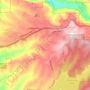
Name: Pollock Pines topographic map, elevation, terrain.
Average elevation: 1,118 m
Minimum elevation: 727 m
Maximum elevation: 1,344 m
Other topographic maps
Click on a map to view its topography, its elevation and its terrain.
South Lake Tahoe
États-Unis d'Amérique > Californie > El Dorado County > South Lake Tahoe
South Lake Tahoe, El Dorado County, Californie, États-Unis d'Amérique
Average elevation: 1,979 m