
Paranhos topographic map
Interactive map
Click on the map to display elevation.
About this map
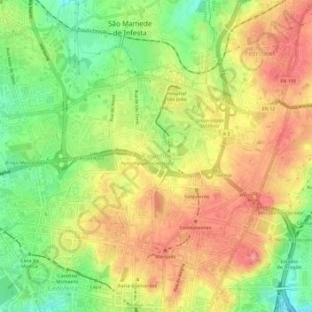
Name: Paranhos topographic map, elevation, terrain.
Location: Paranhos, Porto, Portugal (41.16182 -8.62784 41.18594 -8.57181)
Average elevation: 116 m
Minimum elevation: 55 m
Maximum elevation: 171 m
Other topographic maps
Click on a map to view its topography, its elevation and its terrain.