
Thank you for supporting this site ❤️
Make a donation
Make a donation
Hamer topographic map
Click on the map to display elevation.
Thank you for supporting this site ❤️
Make a donation
Make a donation
Hamer
Its elevation is 144 feet (44 m).
Thank you for supporting this site ❤️
Make a donation
Make a donation
About this map
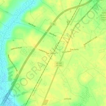
Name: Hamer topographic map, elevation, terrain.
Location: Hamer, Dillon County, South Carolina, 29547, United States (34.45794 -79.35088 34.49794 -79.31088)
Average elevation: 42 m
Minimum elevation: 28 m
Maximum elevation: 49 m
Thank you for supporting this site ❤️
Make a donation
Make a donation
Other topographic maps
Click on a map to view its topography, its elevation and its terrain.