
Golaghat topographic map
Click on the map to display elevation.
Golaghat
Golaghat is located at 26°31′N 93°58′E / 26.52°N 93.97°E / 26.52; 93.97. It has an average elevation of 95 metres (312 feet).
About this map
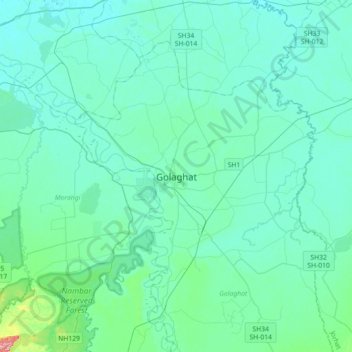
Name: Golaghat topographic map, elevation, terrain.
Location: Golaghat, Assam, 785621, India (26.35083 93.81437 26.67083 94.13437)
Average elevation: 99 m
Minimum elevation: 80 m
Maximum elevation: 253 m
Other topographic maps
Click on a map to view its topography, its elevation and its terrain.