
Thank you for supporting this site ❤️
Make a donation
Make a donation
Verkhoyansk topographic map
Click on the map to display elevation.
Thank you for supporting this site ❤️
Make a donation
Make a donation
Verkhoyansk
In this area, temperature inversions consistently form in winter due to the extremely cold and dense air of the Siberian High pooling in deep hollows, so that temperatures increase rather than decrease with higher altitude. In Verkhoyansk it sometimes happens that the average minimum temperatures for January, February, and December are below −50 °C (−58 °F).
Thank you for supporting this site ❤️
Make a donation
Make a donation
About this map
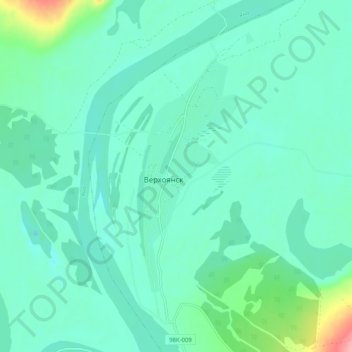
Name: Verkhoyansk topographic map, elevation, terrain.
Average elevation: 140 m
Minimum elevation: 120 m
Maximum elevation: 225 m
Thank you for supporting this site ❤️
Make a donation
Make a donation
Other topographic maps
Click on a map to view its topography, its elevation and its terrain.