
Thank you for supporting this site ❤️
Make a donation
Make a donation
Bapaume topographic map
Click on the map to display elevation.
Thank you for supporting this site ❤️
Make a donation
Make a donation
About this map
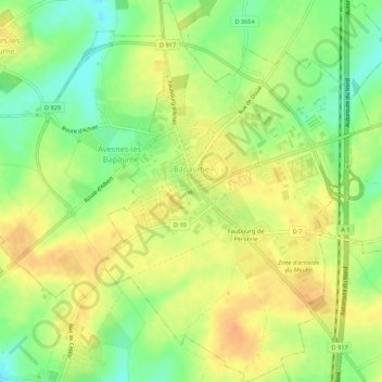
Name: Bapaume topographic map, elevation, terrain.
Average elevation: 123 m
Minimum elevation: 103 m
Maximum elevation: 138 m
Thank you for supporting this site ❤️
Make a donation
Make a donation
Other topographic maps
Click on a map to view its topography, its elevation and its terrain.
Thank you for supporting this site ❤️
Make a donation
Make a donation
Cité n°5 de Béthune
France > Hauts-de-France > Pas-de-Calais > Grenay > Cité n°5 de Béthune
Average elevation: 59 m