
Thank you for supporting this site ❤️
Make a donation
Make a donation
Eaux Rousses topographic map
Click on the map to display elevation.
Thank you for supporting this site ❤️
Make a donation
Make a donation
About this map
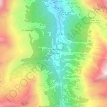
Name: Eaux Rousses topographic map, elevation, terrain.
Location: Eaux Rousses, Valsavarenche, Valle d'Aosta, Italia (45.54681 7.18795 45.58681 7.22795)
Average elevation: 2,208 m
Minimum elevation: 1,546 m
Maximum elevation: 3,070 m
Thank you for supporting this site ❤️
Make a donation
Make a donation
Other topographic maps
Click on a map to view its topography, its elevation and its terrain.