
Risch-Rotkreuz topographic map
Interactive map
Click on the map to display elevation.
About this map
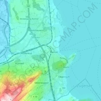
Name: Risch-Rotkreuz topographic map, elevation, terrain.
Location: Risch-Rotkreuz, Zoug, 6343, Suisse (47.11345 8.41196 47.17129 8.48939)
Average elevation: 452 m
Minimum elevation: 397 m
Maximum elevation: 791 m