
Thank you for supporting this site ❤️
Make a donation
Make a donation
Foxhol topographic map
Click on the map to display elevation.
Thank you for supporting this site ❤️
Make a donation
Make a donation
About this map
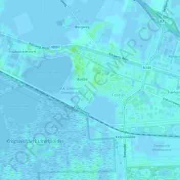
Name: Foxhol topographic map, elevation, terrain.
Location: Foxhol, Midden-Groningen, Groningen, Nederland (53.16164 6.69567 53.17426 6.72890)
Average elevation: 1 m
Minimum elevation: -9 m
Maximum elevation: 8 m
Thank you for supporting this site ❤️
Make a donation
Make a donation
Other topographic maps
Click on a map to view its topography, its elevation and its terrain.
Thank you for supporting this site ❤️
Make a donation
Make a donation
Jipsinghuizen
Nederland > Groningen > Sellingen > Jipsinghuizen
In 1915 kreeg Jipsinghuizen een station aan de stoomtramlijn Winschoten - Ter Apel van de OG. De lijn werd in 1948 opgeheven, maar het station is anno 2006 nog aanwezig op de hoek Weenderstraat-Wollinghuizerweg. Een kilometer ten zuidoosten van Jipsinghuizen ligt de Jipsinghuizersluis in het Ruiten-Aa-kanaal.…
Average elevation: 6 m
Thank you for supporting this site ❤️
Make a donation
Make a donation