
Limogne-en-Quercy topographic map
Interactive map
Click on the map to display elevation.
About this map
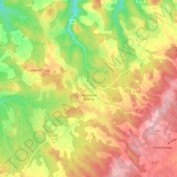
Name: Limogne-en-Quercy topographic map, elevation, terrain.
Average elevation: 306 m
Minimum elevation: 196 m
Maximum elevation: 401 m
Other topographic maps
Click on a map to view its topography, its elevation and its terrain.
Le Cingle-Haut
France > Occitanie > Lot > Figeac
Le Cingle-Haut, Figeac, Lot, Occitanie, France métropolitaine, 46100, France
Average elevation: 270 m
Castelfranc
Castelfranc, Cahors, Lot, Occitanie, France métropolitaine, 46140, France
Average elevation: 160 m
Saint-Martin-Labouval
Saint-Martin-Labouval, Cahors, Lot, Occitanie, France métropolitaine, 46330, France
Average elevation: 272 m