
Thank you for supporting this site ❤️
Make a donation
Make a donation
Sauk Rapids topographic map
Click on the map to display elevation.
Thank you for supporting this site ❤️
Make a donation
Make a donation
About this map
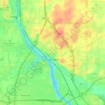
Name: Sauk Rapids topographic map, elevation, terrain.
Location: Sauk Rapids, Benton County, Minnesota, 56379, United States (45.57377 -94.19687 45.61869 -94.09063)
Average elevation: 323 m
Minimum elevation: 299 m
Maximum elevation: 349 m
Thank you for supporting this site ❤️
Make a donation
Make a donation
Other topographic maps
Click on a map to view its topography, its elevation and its terrain.