
Make a donation
Garešnica topographic map
Click on the map to display elevation.
Make a donation
About this map
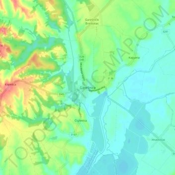
Name: Garešnica topographic map, elevation, terrain.
Average elevation: 126 m
Minimum elevation: 103 m
Maximum elevation: 180 m
Make a donation
Other topographic maps
Click on a map to view its topography, its elevation and its terrain.
Grad Bjelovar
Croatia > Bjelovar-Bilogora County
Bjelovar sits on a plateau in the southern part of the Bilogora, a long, low elevation range with an average height of 150–200 m (highest point: Rajčevica, 309 m). The geology of the area consists of Pliocene sandy marl and sandstones with lesser layers of lignite. Older rocks do not appear on the surface…
Average elevation: 138 m
Make a donation