
Thank you for supporting this site ❤️
Make a donation
Make a donation
Lake Station topographic map
Click on the map to display elevation.
Thank you for supporting this site ❤️
Make a donation
Make a donation
About this map
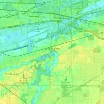
Name: Lake Station topographic map, elevation, terrain.
Location: Lake Station, Lake County, Indiana, 46405, United States (41.55081 -87.31253 41.59456 -87.22170)
Average elevation: 189 m
Minimum elevation: 178 m
Maximum elevation: 203 m
Thank you for supporting this site ❤️
Make a donation
Make a donation
Other topographic maps
Click on a map to view its topography, its elevation and its terrain.