
Thank you for supporting this site ❤️
Make a donation
Make a donation
Baldwin topographic map
Click on the map to display elevation.
Thank you for supporting this site ❤️
Make a donation
Make a donation
About this map
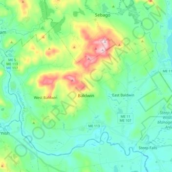
Name: Baldwin topographic map, elevation, terrain.
Location: Baldwin, Cumberland County, Maine, United States (43.78802 -70.80161 43.89018 -70.62679)
Average elevation: 151 m
Minimum elevation: 66 m
Maximum elevation: 419 m
Thank you for supporting this site ❤️
Make a donation
Make a donation
Other topographic maps
Click on a map to view its topography, its elevation and its terrain.
Cliff Island
United States > Maine > Cumberland County > Portland > Cliff Island
Average elevation: 1 m
Thank you for supporting this site ❤️
Make a donation
Make a donation
Thank you for supporting this site ❤️
Make a donation
Make a donation