
Thank you for supporting this site ❤️
Make a donation
Make a donation
Heruru topographic map
Click on the map to display elevation.
Thank you for supporting this site ❤️
Make a donation
Make a donation
About this map
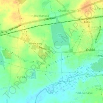
Name: Heruru topographic map, elevation, terrain.
Location: Heruru, Gubbi taluk, Tumakuru, Karnataka, 572216, India (13.28880 76.90452 13.32880 76.94452)
Average elevation: 781 m
Minimum elevation: 766 m
Maximum elevation: 800 m
Thank you for supporting this site ❤️
Make a donation
Make a donation