
Thank you for supporting this site ❤️
Make a donation
Make a donation
Stetten (SH) topographic map
Click on the map to display elevation.
Thank you for supporting this site ❤️
Make a donation
Make a donation
Stetten (SH)
Stetten befindet sich auf einer Anhöhe einige Kilometer nordöstlich der Stadt Schaffhausen auf ca. 570 m über Meer.
Thank you for supporting this site ❤️
Make a donation
Make a donation
About this map
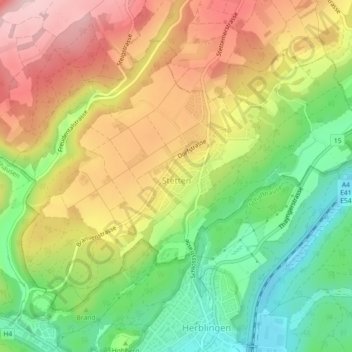
Name: Stetten (SH) topographic map, elevation, terrain.
Location: Stetten (SH), Schaffhausen, 8234, Schweiz (47.72547 8.63793 47.74891 8.68321)
Average elevation: 539 m
Minimum elevation: 420 m
Maximum elevation: 666 m
Thank you for supporting this site ❤️
Make a donation
Make a donation
Other topographic maps
Click on a map to view its topography, its elevation and its terrain.