
Thank you for supporting this site ❤️
Make a donation
Make a donation
Lone Grove topographic map
Click on the map to display elevation.
Thank you for supporting this site ❤️
Make a donation
Make a donation
About this map
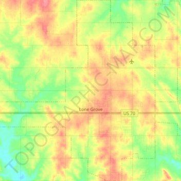
Name: Lone Grove topographic map, elevation, terrain.
Location: Lone Grove, Carter County, Oklahoma, 73443, United States (34.12915 -97.33518 34.24556 -97.21276)
Average elevation: 274 m
Minimum elevation: 240 m
Maximum elevation: 307 m
Thank you for supporting this site ❤️
Make a donation
Make a donation
Other topographic maps
Click on a map to view its topography, its elevation and its terrain.