Geolocate

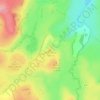
48260 topographic map

Click on the map to display elevation.

About this map

Name: 48260 topographic map, elevation, terrain.

Location: 48260, Nasbinals, Mende, Lozère, Occitanie, France métropolitaine, France (44.58173 2.98226 44.75948 3.14833)

Average elevation: 1,215 m

Minimum elevation: 876 m

Maximum elevation: 1,431 m

Other topographic maps

Click on a map to view its topography, its elevation and its terrain.

Le Trap-du-Milieu

France > Occitanie > Lozère > Nasbinals

Average elevation: 1,338 m

Le Barthas

France > Occitanie > Lozère > Nasbinals

Average elevation: 1,235 m

Le Coustat

France > Occitanie > Lozère > Nasbinals

Average elevation: 1,202 m