
Thank you for supporting this site ❤️
Make a donation
Make a donation
Pleasant City topographic map
Click on the map to display elevation.
Thank you for supporting this site ❤️
Make a donation
Make a donation
About this map
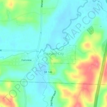
Name: Pleasant City topographic map, elevation, terrain.
Location: Pleasant City, Guernsey County, Ohio, United States (39.90110 -81.55063 39.90619 -81.53798)
Average elevation: 260 m
Minimum elevation: 237 m
Maximum elevation: 312 m
Thank you for supporting this site ❤️
Make a donation
Make a donation
Other topographic maps
Click on a map to view its topography, its elevation and its terrain.