
Thank you for supporting this site ❤️
Make a donation
Make a donation
Brunswick topographic map
Click on the map to display elevation.
Thank you for supporting this site ❤️
Make a donation
Make a donation
About this map
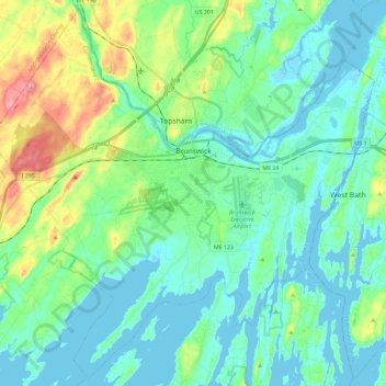
Name: Brunswick topographic map, elevation, terrain.
Location: Brunswick, Cumberland County, Maine, 04011, United States (43.81671 -70.08789 43.97567 -69.85703)
Average elevation: 24 m
Minimum elevation: -3 m
Maximum elevation: 102 m
Thank you for supporting this site ❤️
Make a donation
Make a donation
Other topographic maps
Click on a map to view its topography, its elevation and its terrain.
Cliff Island
United States > Maine > Cumberland County > Portland > Cliff Island
Average elevation: 1 m
Thank you for supporting this site ❤️
Make a donation
Make a donation
Thank you for supporting this site ❤️
Make a donation
Make a donation