Geolocate
👉 Easily get elevation data in JSON, GeoTIFF and KML formats using Elevation API
Thank you for supporting this site ❤️
Make a donation

Hukay topographic map

Click on the map to display elevation.

👉 Easily get elevation data in JSON, GeoTIFF and KML formats using Elevation API
Thank you for supporting this site ❤️
Make a donation

About this map

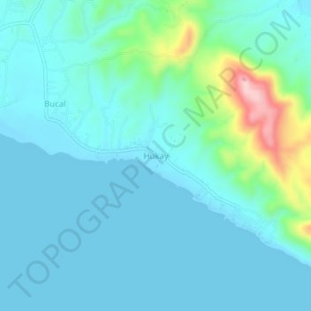
Name: Hukay topographic map, elevation, terrain.

Location: Hukay, Calatagan, Batangas, Calabarzon, Philippines (13.83091 120.67563 13.87091 120.71563)

Average elevation: 43 m

Minimum elevation: -1 m

Maximum elevation: 236 m

Other topographic maps

Click on a map to view its topography, its elevation and its terrain.

Burot Beach

Philippines > Batangas > Calatagan

Average elevation: 3 m

Pagapas Bay

Philippines > Batangas > Calatagan

Average elevation: 15 m