
Thank you for supporting this site ❤️
Make a donation
Make a donation
Ontonagon County topographic map
Click on the map to display elevation.
Thank you for supporting this site ❤️
Make a donation
Make a donation
About this map
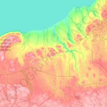
Name: Ontonagon County topographic map, elevation, terrain.
Location: Ontonagon County, Michigan, United States (46.33230 -89.88806 47.03128 -88.86374)
Average elevation: 334 m
Minimum elevation: 174 m
Maximum elevation: 587 m
Thank you for supporting this site ❤️
Make a donation
Make a donation
Other topographic maps
Click on a map to view its topography, its elevation and its terrain.