
Salzburg topographic map
Interactive map
Click on the map to display elevation.
About this map
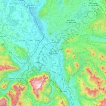
Name: Salzburg topographic map, elevation, terrain.
Location: Salzburg, 5020, Oostenrijk (47.63813 12.88648 47.95813 13.20648)
Average elevation: 676 m
Minimum elevation: 385 m
Maximum elevation: 1,932 m
Other topographic maps
Click on a map to view its topography, its elevation and its terrain.