
Thank you for supporting this site ❤️
Make a donation
Make a donation
Elyria topographic map
Click on the map to display elevation.
Thank you for supporting this site ❤️
Make a donation
Make a donation
About this map
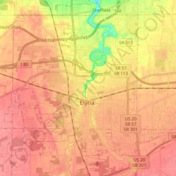
Name: Elyria topographic map, elevation, terrain.
Location: Elyria, Lorain County, Ohio, 44035, United States (41.33303 -82.17946 41.41845 -82.04308)
Average elevation: 223 m
Minimum elevation: 177 m
Maximum elevation: 243 m
Thank you for supporting this site ❤️
Make a donation
Make a donation
Other topographic maps
Click on a map to view its topography, its elevation and its terrain.
Pine Ridge Trailer Park
United States > Ohio > Lorain County > North Ridgeville
Average elevation: 228 m
Thank you for supporting this site ❤️
Make a donation
Make a donation