
Thank you for supporting this site ❤️
Make a donation
Make a donation
Natchitoches topographic map
Click on the map to display elevation.
Thank you for supporting this site ❤️
Make a donation
Make a donation
About this map
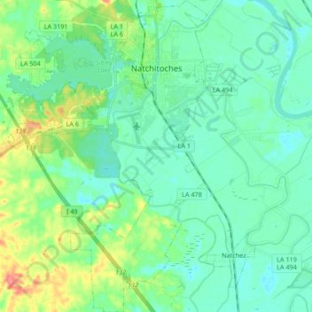
Name: Natchitoches topographic map, elevation, terrain.
Location: Natchitoches, Natchitoches Parish, Louisiana, United States (31.64959 -93.16679 31.79173 -93.05035)
Average elevation: 41 m
Minimum elevation: 24 m
Maximum elevation: 94 m
Thank you for supporting this site ❤️
Make a donation
Make a donation
Other topographic maps
Click on a map to view its topography, its elevation and its terrain.
Thank you for supporting this site ❤️
Make a donation
Make a donation
East Natchitoches
United States > Louisiana > Natchitoches Parish > Natchitoches
Average elevation: 38 m