
Thank you for supporting this site ❤️
Make a donation
Make a donation
La Chiusa topographic map
Click on the map to display elevation.
Thank you for supporting this site ❤️
Make a donation
Make a donation
About this map
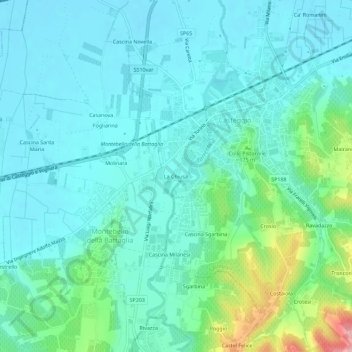
Name: La Chiusa topographic map, elevation, terrain.
Location: La Chiusa, Casteggio, Pavia, Lombardia, 27045, Italia (44.98768 9.09407 45.02768 9.13407)
Average elevation: 109 m
Minimum elevation: 76 m
Maximum elevation: 245 m
Thank you for supporting this site ❤️
Make a donation
Make a donation