
Thank you for supporting this site ❤️
Make a donation
Make a donation
Dreiborn topographic map
Click on the map to display elevation.
Thank you for supporting this site ❤️
Make a donation
Make a donation
Dreiborn
Touristisch interessant sind die Höhenlage mit weitem Fernblick, der Nationalpark Eifel, die Dreiborner Hochfläche, die Nähe zur Olef- und Urfttalsperre, die Vielzahl der markierten Wander- und Radwege und die Anbindung an das ÖPNV-Netz des VRS.
Thank you for supporting this site ❤️
Make a donation
Make a donation
About this map
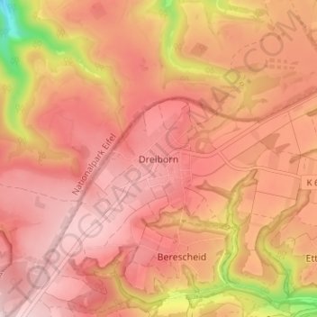
Name: Dreiborn topographic map, elevation, terrain.
Average elevation: 525 m
Minimum elevation: 333 m
Maximum elevation: 604 m
Thank you for supporting this site ❤️
Make a donation
Make a donation
Other topographic maps
Click on a map to view its topography, its elevation and its terrain.
53937
Deutschland > Nordrhein-Westfalen > Kreis Euskirchen > Schleiden > Morsbach
Average elevation: 502 m