
Groede topographic map
Interactive map
Click on the map to display elevation.
About this map
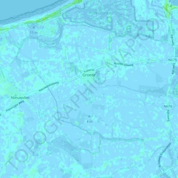
Name: Groede topographic map, elevation, terrain.
Location: Groede, Sluis, Zeeland, Nederland (51.34713 3.46558 51.40253 3.54848)
Average elevation: 0 m
Minimum elevation: -4 m
Maximum elevation: 8 m
Other topographic maps
Click on a map to view its topography, its elevation and its terrain.
Retranchement
Retranchement, Sluis, Zeeland, Nederland
Average elevation: 1 m