
Thank you for supporting this site ❤️
Make a donation
Make a donation
Sungai Limau topographic map
Click on the map to display elevation.
Thank you for supporting this site ❤️
Make a donation
Make a donation
About this map
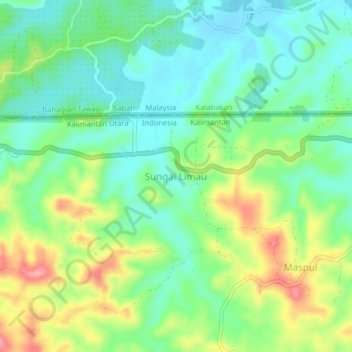
Name: Sungai Limau topographic map, elevation, terrain.
Location: Sungai Limau, Nunukan, North Kalimantan, Kalimantan, Indonesia (4.13954 117.79968 4.17954 117.83968)
Average elevation: 42 m
Minimum elevation: 3 m
Maximum elevation: 113 m
Thank you for supporting this site ❤️
Make a donation
Make a donation