
Thornland Wood topographic map
Interactive map
Click on the map to display elevation.
About this map
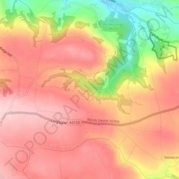
Name: Thornland Wood topographic map, elevation, terrain.
Average elevation: 186 m
Minimum elevation: 36 m
Maximum elevation: 266 m
Other topographic maps
Click on a map to view its topography, its elevation and its terrain.
Swimbridge
United Kingdom > England > Devon > North Devon
Swimbridge, North Devon, Devon, England, United Kingdom
Average elevation: 126 m
St John's Chapel
United Kingdom > England > Devon > North Devon > Eastacombe
St John's Chapel, Tawstock, Eastacombe, North Devon, Devon, England, EX31 3PB, United Kingdom
Average elevation: 78 m
Ilfracombe
United Kingdom > England > Devon > North Devon
Ilfracombe, North Devon, Devon, England, United Kingdom
Average elevation: 104 m
Lynmouth
United Kingdom > England > Devon > North Devon > Lynmouth
Lynmouth, North Devon, Devon, England, EX35 6ES, United Kingdom
Average elevation: 128 m
Barnstaple
United Kingdom > England > Devon > North Devon
Barnstaple, North Devon, Devon, England, United Kingdom
Average elevation: 47 m