
Thank you for supporting this site ❤️
Make a donation
Make a donation
Rendeux topographic map
Click on the map to display elevation.
Thank you for supporting this site ❤️
Make a donation
Make a donation
About this map
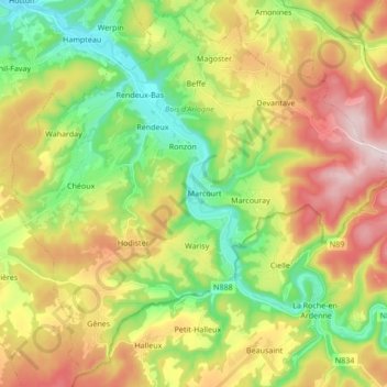
Name: Rendeux topographic map, elevation, terrain.
Location: Rendeux, Marche-en-Famenne, Luxembourg, Wallonie, 6987, Belgique (50.16364 5.44198 50.26507 5.61215)
Average elevation: 338 m
Minimum elevation: 173 m
Maximum elevation: 559 m
Thank you for supporting this site ❤️
Make a donation
Make a donation
Other topographic maps
Click on a map to view its topography, its elevation and its terrain.
Plain de Holset
Belgique > Luxembourg > Marche-en-Famenne > Durbuy > Grandhan
Average elevation: 182 m
Thank you for supporting this site ❤️
Make a donation
Make a donation