
Thank you for supporting this site ❤️
Make a donation
Make a donation
Wheeling topographic map
Click on the map to display elevation.
Thank you for supporting this site ❤️
Make a donation
Make a donation
About this map
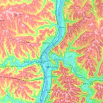
Name: Wheeling topographic map, elevation, terrain.
Location: Wheeling, Ohio County, West Virginia, 26003, United States (40.01609 -80.73904 40.15249 -80.64296)
Average elevation: 305 m
Minimum elevation: 190 m
Maximum elevation: 408 m
Thank you for supporting this site ❤️
Make a donation
Make a donation