
Balaguer topographic map
Click on the map to display elevation.
About this map
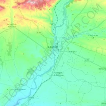
Name: Balaguer topographic map, elevation, terrain.
Location: Balaguer, Noguera, Cataluña, 25600, España (41.73067 0.73231 41.83131 0.93081)
Average elevation: 272 m
Minimum elevation: 179 m
Maximum elevation: 606 m
Other topographic maps
Click on a map to view its topography, its elevation and its terrain.