
Make a donation
Chaoyang District topographic map
Click on the map to display elevation.
Make a donation
About this map
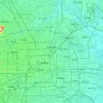
Name: Chaoyang District topographic map, elevation, terrain.
Location: Chaoyang District, Beijing, China (39.80834 116.34472 40.11014 116.63927)
Average elevation: 41 m
Minimum elevation: 18 m
Maximum elevation: 215 m
Make a donation
Other topographic maps
Click on a map to view its topography, its elevation and its terrain.
Beijing
Beijing is situated at the northern tip of the roughly triangular North China Plain, which opens to the south and east of the city. Mountains to the north, northwest and west shield the city and northern China's agricultural heartland from the encroaching desert steppes. The northwestern part of the…
Average elevation: 47 m
Make a donation
Make a donation
Make a donation
Make a donation
Make a donation
Beijing
Beijing is situated at the northern tip of the roughly triangular North China Plain, which opens to the south and east of the city. Mountains to the north, northwest and west shield the city and northern China's agricultural heartland from the encroaching desert steppes. The northwestern part of the…
Average elevation: 47 m
Make a donation
Make a donation
Make a donation