
Thank you for supporting this site ❤️
Make a donation
Make a donation
Hofors kommun topographic map
Click on the map to display elevation.
Thank you for supporting this site ❤️
Make a donation
Make a donation
About this map
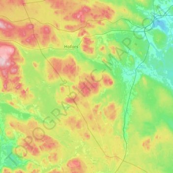
Name: Hofors kommun topographic map, elevation, terrain.
Location: Hofors kommun, Gävleborg County, Sweden (60.35543 16.13651 60.61406 16.66900)
Average elevation: 147 m
Minimum elevation: 57 m
Maximum elevation: 324 m
Thank you for supporting this site ❤️
Make a donation
Make a donation
Other topographic maps
Click on a map to view its topography, its elevation and its terrain.