
Thank you for supporting this site ❤️
Make a donation
Make a donation
Pali Tahsil topographic map
Click on the map to display elevation.
Thank you for supporting this site ❤️
Make a donation
Make a donation
About this map
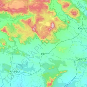
Name: Pali Tahsil topographic map, elevation, terrain.
Location: Pali Tahsil, Korba District, Chhattisgarh, India (22.20667 82.13303 22.65534 82.59182)
Average elevation: 416 m
Minimum elevation: 273 m
Maximum elevation: 1,031 m
Thank you for supporting this site ❤️
Make a donation
Make a donation