
Thank you for supporting this site ❤️
Make a donation
Make a donation
Aïn Fezza topographic map
Click on the map to display elevation.
Thank you for supporting this site ❤️
Make a donation
Make a donation
About this map
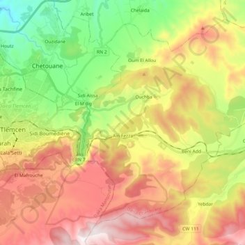
Name: Aïn Fezza topographic map, elevation, terrain.
Location: Aïn Fezza, Chetouane, Tlemcen, Algeria (34.82258 -1.26590 34.94919 -1.08368)
Average elevation: 883 m
Minimum elevation: 314 m
Maximum elevation: 1,539 m
Thank you for supporting this site ❤️
Make a donation
Make a donation
Other topographic maps
Click on a map to view its topography, its elevation and its terrain.