
Caínha topographic map
Interactive map
Click on the map to display elevation.
About this map
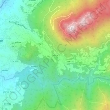
Name: Caínha topographic map, elevation, terrain.
Average elevation: 400 m
Minimum elevation: 127 m
Maximum elevation: 930 m
Other topographic maps
Click on a map to view its topography, its elevation and its terrain.
Bezerral
Portugal > Vila Real > Mondim de Basto > Vilar de Ferreiros
Bezerral, Vilar de Ferreiros, Mondim de Basto, Vila Real, 4880-316, Portugal
Average elevation: 602 m